
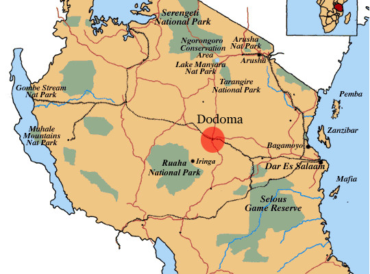
Tanzania: 5.1 Earthquake Hits Dodoma
An earthquake hit 55 kilometres south-southeast of Kondoa District in Dodoma on Friday.
It was a sizeable quake,and its effects were felt in several surrounding areas,though damage was minimal. According to a report posted on US National Earthquake Information Centre (NEIC) on Saturday, the quake registered a magnitude of 5.1 and a depth of just 10 kilometers.
The region has experienced nine seismic events in the last four years of a magnitude of at least 4.5 or higher.
This one on Friday evening represents the strongest over that four year period, further noted the NEIC.
The mission of the is to determine rapidly the location and size of all destructive earthquakes worldwide and to immediately disseminate this information to concerned national and international agencies, scientists, and the general public.
The NEIC compiles and maintains an extensive, global seismic database on earthquake parameters and their effects that serves as a solid foundation for basic and applied earth science research.
However, Tanzania Meteorological Agency officials were not immediately available for comments.
Two major geological faults run parallel from north to south in Tanzania, forming the country's major earthquake- prone belts with one running from Mount Kilimanjaro to Dodoma via Arusha and the other from Kigoma to Mbeya.
Both geological faults are part of the East African Rift Valley system that is a zone of 50-60 km wide with active volcanoes.
Tanzania is less prone to earthquakes in the east and more prone to tremors in the west, especially along the shores of Lake Tanganyika in westernmost Tanzania bordering the Democratic Republic of Congo.
Most of Tanzania's 26 administrative regions are located in Zone 0 or "safe zone" where the magnitude and impact of rare quakes are minimal as this zone experiences mostly unfelt quakes measuring 0-3 on the openend Richter scale.
The regions between the two faults and the Indian Ocean coast are in Zone 1 where earthquakes measure between 3 and 5 on the Richter scale in magnitude.
Zone 2 includes regions of Kilimanjaro, Arusha, Dodoma, Iringa and Ruvuma along the Mount Kilimanjaro-Arusha- Dodoma fault.
The area saw earthquake measuring 5-6 on the Richter scale. Zone 3 or regions along the eastern shores of Lake Tanganyika encounter frequent and strong earthquakes that measure 6-7 on the Richter scale.
It was in Lake Tanganyika, the deepest and longest on the African continent, where the strongest earthquakes affecting Tanzania had been recorded.
Tanzania's ever-recorded strongest earthquake was a 7.4- magnitude jolt that occurred in 1910 in Lake Tanganyika, followed by the second strongest quake of 6.8 on the Richter scale on December 5, 2005.
SORCE: DAILY NEWS
No comments:
Post a Comment